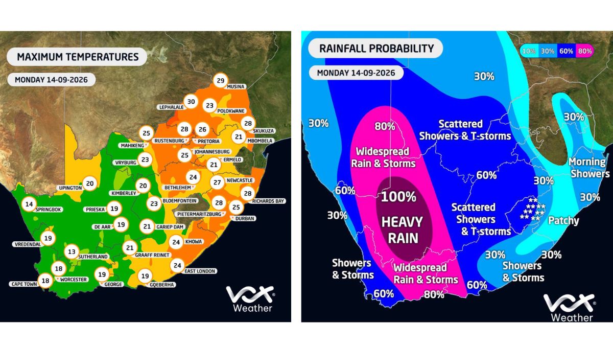
The South African Weather Service (SAWS) has issued several yellow-level warnings for Monday, with disruptive rain, possible flooding, severe thunderstorms, damaging winds and very rough seas that could affect parts of the country. A cut-off low-pressure system developing west of the country could affect the Western and Northern Cape. It will bring, among other things, thundershowers, heavy rain, possible hail, lightning, a significant drop in temperature over high-lying areas and strong winds. The sea could be very rough, with waves of between four and 4.5 metres south of Table Bay.
Vox Weather say the cut-off low-pressure system will drive rain and thunderstorms over the western parts of the country on Monday, before the system gradually moves eastward over the central interior. According to Vox Weather conditions could later also reach Gauteng and the Highveld.
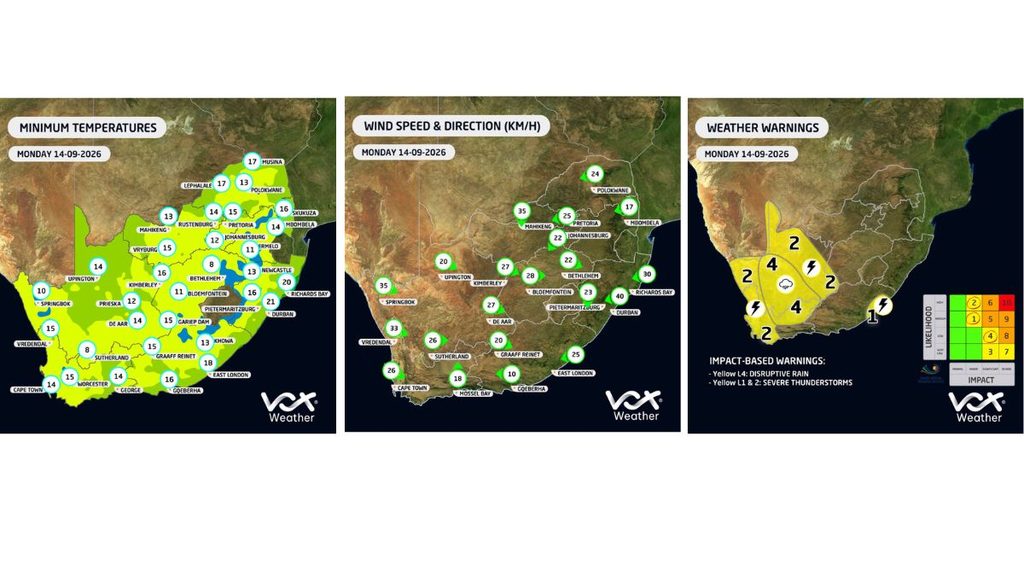
A yellow level 4 warning for disruptive rain has been issued for eastern Namaqualand in the Northern Cape and the Central Karoo district in the Western Cape. Flooding of roads and settlements and major disruption to traffic flow are expected.
A yellow level 2 warning for severe thunderstorms applies to the Nama Khoi and Kamiesberg municipalities in the Northern Cape, as well as the West Coast, Winelands, Overberg and City of Cape Town. The storms could be accompanied by excessive lightning and could cause localised injuries and power outages.
A further yellow level 2 warning for damaging winds is in effect over parts of the North West, the eastern parts of the Northern Cape, central and western parts of the Free State, central and western Limpopo and places in the northern parts of the Eastern Cape.
There is also a yellow level 2 warning for damaging winds and waves between Port Edward and Richards Bay and the adjacent inland areas. This could hamper navigation and cause temporary disruption at small harbours and infrastructure damage.
The SAWS further expects scattered showers and thundershowers over parts of the North West and the Free State, while the Northern Cape and Western Cape will be predominantly cloudy, windy and cool to cold. The Eastern Cape could also experience strong winds and thunderstorms. Along the coast, the wind could be strong between Port Edward and Richards Bay, while a strong to gale-force north-easterly wind along the Wild Coast from the afternoon is possible. There is also a warning that extremely high fire danger conditions could be expected in the western parts of the Waterberg district and the Blouberg municipality in Limpopo.
Motorists and residents in areas under warning are advised to stay up to date with the latest weather information and to exercise caution where heavy rain, strong winds and thunderstorms occur.
This article is an automatic English translation of a Nuusflits article originally published in Afrikaans. Read the Afrikaans original.